The backcountry is calling, and in 2026, it speaks in high-definition satellite imagery. Gone are the days of squinting at pixelated topo lines and wondering if that blue squiggle is a creek or a trail. Today’s handheld GPS units have evolved into sophisticated navigation computers that overlay real-world satellite photography onto your route-finding toolkit, transforming how we plan, execute, and share our outdoor adventures. Whether you’re bushwhacking through untracked wilderness, scouting remote hunting grounds, or leading search-and-rescue operations, the ability to see actual terrain features, vegetation density, and man-made structures directly on your device isn’t just convenient—it’s revolutionary.
But here’s the challenge: not all satellite imagery is created equal, and the marketing jargon can be thicker than mountain fog. What does “high-resolution” actually mean when you’re standing on a rideline in harsh noon sun? How much storage do you really need for offline imagery? And which features separate a true professional-grade tool from a glorified smartphone app in a rugged case? This comprehensive guide cuts through the noise, focusing on the technologies, features, and decision points that matter for serious route-finding in 2026. We’ll explore everything from display innovations to power management strategies, helping you understand what to prioritize for your specific outdoor pursuits.
Top 10 Handheld GPS Units with Satellite Imagery
Detailed Product Reviews
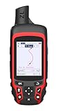
1. Garmin GPSMAP 67i Rugged GPS Handheld with inReach® Satellite Technology, Two-Way Messaging, Interactive SOS, Mapping

Overview: The Garmin GPSMAP 67i is a premium rugged handheld GPS designed for serious backcountry adventurers who need reliable navigation and emergency communication. It combines a bright 3-inch color display with inReach satellite technology, offering two-way messaging and SOS capabilities when you’re beyond cell range. With multi-band GNSS support and preloaded TopoActive maps, it provides accurate positioning even in challenging terrain.
What Makes It Stand Out: The integrated inReach technology is the star feature, connecting to the global Iridium satellite network for true worldwide coverage. Unlike basic GPS units, this allows interactive SOS alerts to Garmin’s 24/7 response center and two-way text messaging with family or rescue services. The multi-band GNSS system delivers superior accuracy in dense forests and urban canyons where single-band devices struggle.
Value for Money: At $599.99, it’s a significant investment, but justifiable for frequent remote travelers. The standalone GPSMAP 66sr (without inReach) costs around $450, making the $150 premium for satellite communication reasonable. When compared to renting satellite communicators or carrying separate devices, the all-in-one convenience adds value. However, the required subscription ($15-65/month) adds ongoing costs.
Strengths and Weaknesses: Pros: Global satellite communication; excellent accuracy with multi-band GNSS; bright sunlight-readable display; comprehensive mapping; long battery life Cons: Expensive upfront cost; mandatory subscription fees; some jurisdictions restrict satellite devices; learning curve for inReach features
Bottom Line: The GPSMAP 67i is essential gear for remote adventurers who prioritize safety and communication. While pricey, its reliable satellite connectivity and robust navigation features make it worth the investment for backcountry hikers, hunters, and expedition leaders who regularly venture off-grid.
2. Garmin Montana® 760i, Rugged GPS Handheld Navigator with Built-in inReach® Technology for SOS and 2-way Texts in Remote Areas, 5” Touchscreen, 8MP Camera, Satellite Imagery and Maps for Road or Trails

Overview: The Montana 760i is Garmin’s flagship large-screen handheld GPS with integrated inReach satellite communication. Its massive 5-inch glove-friendly touchscreen dominates the handheld GPS market, designed for users who want maximum visibility and ease of use. The built-in 8MP camera with geotagging sets it apart from most navigation devices, allowing you to visually document waypoints and return to exact locations later.
What Makes It Stand Out: The combination of a spacious 5-inch display and inReach technology in a single rugged package is unmatched. The touchscreen remains responsive with gloves, crucial for cold-weather adventures. Its integrated camera automatically geotags photos, creating visual breadcrumbs of your journey. The device includes both TopoActive and City Navigator maps, seamlessly transitioning from backcountry trails to urban navigation without additional purchases.
Value for Money: At $699.99, it’s Garmin’s most expensive handheld GPS, but the premium makes sense for specific users. You’re paying $100 more than the 67i for the larger screen and camera. For ATV riders, mountaineers, or marine users who need the visual real estate and mounting flexibility, the cost is justified. However, casual hikers may find the size and price excessive for their needs.
Strengths and Weaknesses: Pros: Massive glove-friendly touchscreen; integrated 8MP camera; comprehensive map bundle; robust inReach communication; versatile mounting options Cons: Bulky and heavy for backpacking; highest price point; shorter battery life than smaller units; touchscreen can be finicky in rain
Bottom Line: The Montana 760i is ideal for motorized adventurers, boaters, and those who prioritize screen size over portability. Its camera and dual-map system add genuine utility, making it worth the premium for users who need maximum visibility and documentation capabilities in remote environments.
3. Garmin 010-02256-00 eTrex 22x, Rugged Handheld GPS Navigator, Black/Navy

Overview: The eTrex 22x is Garmin’s entry-level rugged handheld GPS, offering essential navigation capabilities at an accessible price point. With its compact 2.2-inch sunlight-readable display and straightforward interface, it targets casual hikers, geocachers, and budget-conscious outdoor enthusiasts. Preloaded with TopoActive maps and supporting both GPS and GLONASS satellites, it provides reliable positioning without the complexity or cost of premium models.
What Makes It Stand Out: Its affordability combined with genuine rugged GPS capability makes it unique in Garmin’s lineup. While lacking advanced features like inReach or multi-band GNSS, it delivers core navigation functions that work reliably. The support for GLONASS alongside GPS provides better coverage than smartphone apps in challenging environments. Its simplicity is actually a strength for users overwhelmed by feature-heavy devices.
Value for Money: At $193.11, it’s the best value in Garmin’s handheld range. It offers 80% of the navigation capability of units costing three times as much, minus satellite communication. For day hikers, weekend warriors, or as a backup device, it’s hard to beat. The $400+ savings versus inReach models could fund years of outdoor trips. However, it lacks wireless connectivity and has limited internal memory, requiring careful map management.
Strengths and Weaknesses: Pros: Extremely affordable; simple, reliable operation; GLONASS support; excellent battery life; compact and lightweight Cons: Small screen; no wireless features; limited internal memory; basic processor; no smartphone integration
Bottom Line: The eTrex 22x is perfect for entry-level users or as a secondary navigation tool. It won’t replace a smartphone for communication, but for pure GPS navigation on a budget, it’s an excellent choice that delivers Garmin reliability without unnecessary frills.
4. Garmin GPSMAP 65, Button-Operated Handheld with Expanded Satellite Support and Multi-Band Technology, 2.6" Color Display, 010-02451-00

Overview: The GPSMAP 65 occupies the sweet spot between basic GPS units and premium satellite communicators. Its 2.6-inch button-operated design appeals to traditionalists who prefer tactile controls over touchscreens, especially in harsh weather. With expanded GNSS support and multi-band technology, it delivers professional-grade accuracy in difficult environments like dense forests and steep canyons where consumer GPS devices typically fail.
What Makes It Stand Out: The button-operated interface is increasingly rare but highly valued by mountaineers and winter sports enthusiasts who wear gloves. Its multi-band GNSS technology, typically found in $500+ units, provides surveyor-level accuracy. The inclusion of federal public land maps (U.S. only) is a bonus for hunters and backcountry campers, offering immediate value without additional purchases.
Value for Money: At $319.99, it offers premium GNSS technology at a mid-range price. The GPSMAP 66i with inReach costs nearly double, making the 65 an intelligent choice if you don’t need satellite communication. For users who already carry a separate satellite messenger or primarily venture into areas with some cell coverage, the $280 savings is substantial. The accuracy improvements over the eTrex 22x justify the $130 price difference for serious navigators.
Strengths and Weaknesses: Pros: Multi-band GNSS for superior accuracy; physical buttons for reliable operation; excellent mapping bundle; Garmin Explore compatibility; good battery life Cons: No inReach communication; smaller screen than premium models; button interface has learning curve; limited internal storage
Bottom Line: The GPSMAP 65 is the top choice for accuracy-focused adventurers who don’t require satellite communication. Its button controls and multi-band GNSS make it ideal for technical mountaineering, backcountry skiing, and professional fieldwork where precision matters more than messaging capabilities.
5. Garmin GPSMAP 67i Rugged Hiking GPS Handheld, Premium inReach Satellite Technology, 425 Hr of Battery Life, Two-Way Messaging, Interactive SOS, Mapping Bundle with Accessories

Overview: This GPSMAP 67i bundle packages Garmin’s flagship satellite communicator with essential accessories for serious expeditions. Beyond the standard 67i’s 3-inch display and inReach capabilities, it includes a power bank, 32GB microSD card, charging adapters, and cleaning cloth. With 425 hours of battery life and Wi-Fi map downloads, it’s engineered for extended remote trips where resupply isn’t an option and communication is non-negotiable.
What Makes It Stand Out: The bundle addresses the 67i’s main limitation—storage and power management—for only $12 more than the standalone unit. The included 32GB microSD card and power bank solve two critical expedition challenges: map storage capacity and extended power. The advertised 425-hour battery life (in expedition mode) is among the longest in the industry, and Wi-Fi connectivity enables map updates without a computer, crucial for international travelers.
Value for Money: At $611.99, the bundle represents exceptional value. The accessories (worth $60-80) essentially come free compared to buying separately. For multi-week expeditions, the power bank alone justifies the minimal price increase. The standalone 67i at $599.99 feels incomplete without expanded storage, making this bundle the smarter purchase. The subscription cost remains the only ongoing expense, but that’s unavoidable for satellite communication.
Strengths and Weaknesses: Pros: Comprehensive accessory bundle; exceptional battery life; Wi-Fi map downloads; multi-band GNSS accuracy; global satellite communication Cons: Slightly bulkier with accessories; still requires subscription; initial setup complexity; overkill for casual day hikes
Bottom Line: This bundle is the definitive choice for expedition leaders and remote adventurers. The minimal price premium delivers essential accessories that enhance the 67i’s core strengths. If you’re investing in a satellite communicator for serious backcountry use, this bundle offers complete readiness out of the box.
6. Garmin Montana® 710, Rugged GPS Handheld Navigator with Large 5-inch Glove-Friendly Touchscreen, Satellite Imagery and Maps for Routing on Roads and Trails

Overview: The Garmin Montana 710 represents the pinnacle of handheld GPS technology for serious outdoor enthusiasts. This premium device combines a massive 5-inch glove-friendly touchscreen with military-grade durability and comprehensive mapping capabilities. Designed for adventurers who demand the best, it comes preloaded with TopoActive maps and offers extensive expansion options for various activities from overlanding to marine navigation.
What Makes It Stand Out: The Montana 710’s standout feature is its expansive, high-resolution display that remains usable in harsh conditions while wearing gloves. The MIL-STD 810 rating ensures survival in extreme temperatures, shocks, and vibrations, while IPX7 waterproofing handles submersion. The ability to download high-resolution satellite imagery via Wi-Fi and store extensive map libraries in its 32GB memory sets it apart from competitors. The device seamlessly transitions between road and trail navigation.
Value for Money: At $549, the Montana 710 commands a premium price but delivers commensurate value for dedicated users. Unlike budget alternatives, this is a true multi-purpose navigator that can replace several devices. The build quality ensures years of reliable service, and the extensive mapping ecosystem justifies the investment for frequent adventurers. Casual hikers may find it excessive, but for professionals and serious enthusiasts, it’s worth every dollar.
Strengths and Weaknesses:
- Strengths: Exceptional 5" glove-friendly display; unmatched ruggedness; comprehensive preloaded maps; massive 32GB storage; Wi-Fi connectivity; satellite imagery capability; versatile mounting ecosystem
- Weaknesses: Premium pricing; mounting accessories sold separately; subscription required for Outdoor Maps+; larger size may not suit minimalists; steep learning curve for beginners
Bottom Line: The Garmin Montana 710 is the ultimate handheld GPS for serious adventurers who refuse to compromise. If you regularly venture into remote areas and need a reliable, feature-rich navigator that can handle any conditions, this investment will serve you flawlessly for years.
7. Handheld GPS for Hiking, Rugged and Waterproof Handheld GPS Navigator, 3.2" Sunlight Readable Screen, Compact Satellite Handheld GPS with USA Topo Map, Multi-GNSS Support, Extra Battery Life

Overview: This rugged handheld GPS offers impressive specifications at a mid-range price point, targeting hikers who need reliable navigation without breaking the bank. The device features a bright 3.2-inch sunlight-readable display and supports multiple global navigation satellite systems for enhanced accuracy. Its compact design houses a 36-hour battery and essential sensors for comprehensive outdoor navigation.
What Makes It Stand Out: The multi-GNSS support (GPS, Galileo, Beidou, QZSS) delivers positioning accuracy within 6 feet, outperforming many competitors in challenging terrain. The IP66 water resistance and anti-slip design ensure functionality in adverse weather. Physical buttons complement the touchscreen for versatile operation. The inclusion of a 3-axis compass and barometric altimeter at this price point is remarkable, providing professional-grade navigation tools for elevation tracking and bearing determination.
Value for Money: Priced at $159.99, this device represents excellent value for recreational hikers and outdoor enthusiasts. It bridges the gap between budget units and premium Garmin models, offering 80% of the functionality at less than one-third the cost. The 36-hour battery life exceeds many pricier alternatives, and USB-C charging adds modern convenience. While it lacks the brand recognition and extensive accessory ecosystem of Garmin, the feature-to-price ratio is compelling.
Strengths and Weaknesses:
- Strengths: Multi-GNSS support for superior accuracy; excellent 36-hour battery life; bright sunlight-readable screen; IP66 water resistance; 3-axis compass and barometric altimeter; USB-C charging; competitive pricing
- Weaknesses: Generic brand may raise durability concerns; limited mapping detail compared to Garmin; smaller screen than premium models; no mention of expandable storage; customer support uncertainty
Bottom Line: This handheld GPS is an excellent choice for budget-conscious hikers who demand reliable navigation and modern features. It sacrifices brand prestige for substantial cost savings while maintaining impressive technical specifications. Ideal for weekend warriors and casual adventurers.
8. Garmin inReach Mini 2, Lightweight and Compact Satellite Communicator, Hiking Handheld, Orange - 010-02602-00

Overview: The Garmin inReach Mini 2 revolutionizes backcountry safety by combining essential GPS navigation with global two-way satellite communication. This ultra-compact device weighs just 3.5 ounces yet provides life-saving SOS capabilities, messaging, and location sharing anywhere on Earth. It’s designed as a safety companion rather than a primary mapping device, perfect for solo adventurers and remote expeditions.
What Makes It Stand Out: The Mini 2’s satellite communication capabilities are its defining feature, offering interactive SOS with 24/7 monitoring and two-way messaging when you’re beyond cellular range. The TracBack routing automatically guides you back to your starting point, while the digital compass works even when stationary. Integration with the Garmin Explore app allows for seamless trip planning and topographical mapping on your smartphone, effectively expanding its capabilities.
Value for Money: At $303.45 plus a required satellite subscription, the Mini 2 is a significant but justified investment in safety. The peace of mind it provides for remote adventures is priceless. While more expensive than basic GPS units, no other device in this size and price range offers comparable communication capabilities. The subscription cost ($15-65/month) is the real consideration, making it best for frequent backcountry travelers rather than occasional hikers.
Strengths and Weaknesses:
- Strengths: Global two-way satellite messaging; interactive SOS with emergency response; extremely lightweight and compact; TracBack routing; Garmin Explore app integration; digital compass; location sharing
- Weaknesses: Requires ongoing satellite subscription; small screen not suited for detailed map viewing; limited standalone navigation; subscription costs add up; some jurisdictions restrict satellite communicators
Bottom Line: The inReach Mini 2 is an essential safety device for anyone venturing beyond cell service. While not a replacement for a full-featured GPS, its communication capabilities make it indispensable for remote adventures. The subscription cost is worthwhile for serious backcountry enthusiasts.
9. Garmin eTrex 32x, Rugged Handheld GPS Navigator

Overview: The Garmin eTrex 32x continues the legacy of Garmin’s most popular handheld GPS line, offering reliable navigation in a compact, affordable package. This rugged device features a 2.2-inch sunlight-readable display and comes preloaded with TopoActive maps. Its support for both GPS and GLONASS satellites ensures consistent tracking, while 8GB of internal memory provides ample storage for additional maps and waypoints.
What Makes It Stand Out: The eTrex 32x excels in its simplicity and reliability. The dual-satellite system (GPS + GLONASS) maintains signal lock in dense forest and deep canyons where single-system units fail. Its legendary battery efficiency provides up to 25 hours on two AA batteries, offering flexibility for extended trips. The microSD card slot enables virtually unlimited map expansion, while the preloaded TopoActive maps include routable roads and trails for both cycling and hiking.
Value for Money: Priced at $259.99, the eTrex 32x hits the sweet spot for serious hikers seeking Garmin quality without premium pricing. It offers 90% of the navigation functionality of higher-end models at half the cost. The AA battery compatibility is a major advantage for multi-day expeditions where recharging isn’t possible. While it lacks touchscreen convenience and advanced connectivity, its core navigation capabilities are rock-solid, making it a smart investment for practical users.
Strengths and Weaknesses:
- Strengths: Excellent value from trusted brand; GPS + GLONASS satellite support; preloaded TopoActive maps; microSD expansion; exceptional battery life with AA cells; compact and lightweight; proven reliability
- Weaknesses: Small 2.2-inch screen; non-touch display; limited internal memory (8GB); no wireless connectivity; basic interface feels dated; no compass or altimeter mentioned
Bottom Line: The Garmin eTrex 32x is a no-nonsense navigator that prioritizes reliability and value over flashy features. Perfect for hikers who want proven Garmin accuracy without paying for unnecessary extras. An excellent choice for practical adventurers who value function over form.
10. NiesahYan A6 Handheld GPS for Hiking, Rugged Waterproof GPS Navigator with 20 Hrs of Battery Life, 2 Navigation Mode, 2.4" Color Display and GPS Compass, Moon Phase Information
Overview: The NiesahYan A6 positions itself as an entry-level handheld GPS for budget-conscious hikers seeking core navigation features. This compact device offers multi-GNSS support and a 2.4-inch sunlight-readable display in a rugged package. With the ability to store 1,000 waypoints and track navigation capabilities, it covers the fundamentals of outdoor navigation without overwhelming users with complexity.
What Makes It Stand Out: The A6’s quad-GNSS system (GPS, Galileo, BeiDou, QZSS) delivers impressive sub-5-foot accuracy typically found in more expensive units. The inclusion of both waypoint and track navigation modes provides flexibility for different hiking styles. Unique features like moon phase information and sunrise/sunset times cater to hunters and photographers. The side non-slip design and physical buttons ensure operability in challenging conditions, while the 3,500mAh battery provides adequate endurance for day hikes.
Value for Money: At $119.99, the A6 is a compelling entry point into dedicated GPS navigation. It undercuts even Garmin’s budget offerings while providing multi-GNSS support and respectable battery life. The feature set rivals devices costing twice as much, making it ideal for beginners testing GPS navigation or casual hikers who don’t want to drain their phone battery. However, the unknown brand raises questions about long-term support and durability compared to established manufacturers.
Strengths and Weaknesses:
- Strengths: Very affordable price point; multi-GNSS support for excellent accuracy; waypoint and track navigation; moon phase and solar data; physical buttons for reliability; lightweight design; USB-C charging
- Weaknesses: Unknown brand reliability; unspecified waterproof rating; limited to 1,000 waypoints; no expandable storage mentioned; basic screen resolution; questionable long-term support; build quality uncertainty
Bottom Line: The NiesahYan A6 is a surprisingly capable budget GPS that delivers core navigation features at an unbeatable price. Best suited for beginners or casual hikers who want dedicated GPS functionality without significant investment. Accept the brand risk for substantial savings.
The Evolution of Handheld GPS Technology in 2026
The handheld GPS market has undergone a seismic shift over the past three years. We’ve moved beyond simple waypoint navigation into an era where your device functions as a multi-layered geospatial computer. The integration of satellite imagery isn’t just a feature add-on—it’s fundamentally changed how we interact with digital maps. Modern units process multiple satellite constellations simultaneously (GPS, GLONASS, Galileo, BeiDou, and QZSS), achieving accuracy within one meter even under dense canopy. But raw positioning data is only half the story. The real magic happens when that pinpoint location is displayed against a backdrop of current, high-resolution satellite photography that you can zoom, pan, and analyze in real-time.
Why Satellite Imagery Changes Everything for Route-Finding
Traditional vector-based maps represent terrain through symbolic abstraction: contour lines indicate elevation, blue lines show water, green shading suggests vegetation. Satellite imagery eliminates this translation layer, showing you exactly what exists on the ground. That “shortcut” through a valley? The imagery reveals it’s actually an impenetrable willow thicket. The “clearing” on the ridge? It’s a recent burn scar loaded with deadfall. This visual honesty allows for on-the-fly route adjustments based on actual conditions rather than cartographic guesswork. For professionals managing remote teams or recreationalists exploring off-trail, this reduces decision-making ambiguity and significantly improves safety margins.
Key Satellite Imagery Technologies to Understand
Raster vs. Vector Imagery
Raster imagery consists of pixel-based photographs—actual pictures captured by satellites. These files are large but provide photographic detail. Vector data uses mathematical coordinates to draw lines, points, and polygons. Premium devices layer these intelligently, allowing you to adjust transparency and toggle between pure satellite view, hybrid topo-satellite, or clean vector maps depending on your needs. Understanding this distinction helps you evaluate storage requirements and processing speed.
Resolution and Clarity Standards
In 2026, “high-resolution” means something specific: 30cm per pixel or better for commercial imagery. This lets you identify individual boulders, small structures, and trail treads. However, resolution without dynamic range is useless. Look for devices that support 16-bit color depth and automatic contrast optimization for different terrains—desert, forest, snow. The best units also offer selectable imagery dates, letting you compare seasonal changes or post-storm conditions.
Real-Time vs. Pre-Downloaded Imagery
Some units promise “live” satellite feeds, but this is largely marketing fluff. True real-time imagery requires constant satellite internet connectivity, which is power-prohibitive and expensive. Practical devices use pre-downloaded imagery tiles stored locally, refreshed via Wi-Fi or cellular before your trip. The key differentiator is download efficiency: how quickly can you grab a 50-mile corridor of 30cm imagery, and how intelligently does the device manage tile caching to preserve storage?
Must-Have Display Features for Optimal Viewing
Screen Size and Resolution Benchmarks
For detailed imagery work, 3 inches is the absolute minimum diagonal measurement, with 4 inches being the sweet spot for readability without excessive bulk. Resolution should exceed 300 pixels per inch (PPI) to render crisp imagery. More importantly, look for adjustable backlighting that reaches at least 1000 nits—essential for desert glare or snowfields. Some 2026 models now incorporate ambient light sensors that automatically adjust both brightness and color temperature.
Sunlight Readability and Transflective Technology
Standard LCD screens wash out in direct sun. Transflective displays reflect ambient light to illuminate the screen, making them brilliantly readable even with backlighting off. This technology has matured significantly, with new dual-layer designs that maintain color accuracy while boosting reflectivity. When evaluating devices, test them in actual outdoor light, not just a retail store. The best displays show rich imagery without that muddy, inverted look common in older rugged units.
Touchscreen vs. Button Navigation
Capacitive touchscreens dominate modern devices, offering pinch-to-zoom and intuitive panning. But they fail with gloves or in rain. The solution? Hybrid interfaces with glove-mode touch sensitivity and redundant physical buttons for critical functions like marking waypoints or switching map layers. Look for devices with customizable button mapping—being able to instantly toggle imagery transparency with a single button press is invaluable when navigating complex terrain.
Battery Life: Powering Your Extended Adventures
Battery Types and Swap-Out Options
Lithium-ion packs remain standard, but the game-changer is field-swappable batteries. Some 2026 units accept standard AA lithiums as backup, automatically switching power sources without rebooting. For expedition use, calculate runtime based on your usage pattern: continuous imagery display with high brightness might drain a 3000mAh pack in 6-8 hours, while intermittent use with power-saving modes can stretch to 20+ hours. Always verify manufacturer claims against real-world testing.
Power Management Features
Advanced power profiles are essential. The best devices offer granular control: you can throttle processor speed, reduce GPS update frequency, limit imagery resolution, and disable non-essential sensors. Look for “expedition mode” that updates your position every 30 seconds instead of every second, extending battery life by 40% while still tracking your route. Solar charging compatibility through integrated panels or USB-C pass-through is becoming standard on premium units.
Durability Standards That Actually Matter
IP Ratings and Military Standards Explained
IP68 is the baseline—dust-tight and waterproof to 1.5 meters for 30 minutes. But IP ratings don’t test drop resistance or temperature extremes. MIL-STD-810H certification is more comprehensive, requiring testing for shock, vibration, thermal shock, and humidity. For 2026, look for devices tested to Method 516.8 (shock) and Method 501.7/502.7 (temperature). Some manufacturers now exceed these with internal pressure sensors that detect water intrusion and automatically seal charging ports.
Drop, Shock, and Temperature Resistance
A device can be waterproof but shatter from a waist-high drop onto granite. Quality units feature chemically strengthened glass (Gorilla Glass Victus or equivalent) and internal frame isolation that protects the circuit board from shock. Operating temperature range is critical: -20°C to 60°C covers most alpine and desert use. For polar or high-altitude expeditions, seek units rated to -30°C, and verify that battery performance doesn’t plummet in extreme cold.
Mapping Capabilities Beyond Basic Imagery
Layering Multiple Data Sources
The power of modern GPS units lies in map stacking. You should be able to layer satellite imagery, topo lines, land ownership boundaries, active fire data, and weather radar simultaneously, adjusting each layer’s opacity. This requires robust processing power and intelligent rendering engines that don’t choke when displaying 10+ data streams. Test this by loading a complex mapset and rapidly zooming in/out—lag indicates underpowered hardware.
3D Terrain Visualization
Flat satellite imagery can be misleading; a gentle slope and cliff band look similar from above. 3D terrain modeling extrudes the imagery onto a digital elevation model, letting you rotate the view and assess slope angles, aspect, and potential obstacles. This is invaluable for route planning in mountainous terrain. The best implementations allow offline 3D rendering without cloud processing, though this demands significant storage and GPU capability.
Custom Map Creation and Import
Professionals often need to import their own data: drone imagery, survey maps, or GIS shapefiles. Look for devices supporting GeoTIFF, KMZ, and GPX imports with proper georeferencing. The ability to create custom map packages on your computer and sync them via Wi-Fi saves hours of manual tile downloading. Some units now offer web portals where you can define an area and automatically generate optimized mapsets with your chosen layers and resolution.
Connectivity Features for Modern Explorers
Satellite Communication Integration
Many 2026 GPS units bundle two-way satellite messaging (like Garmin inReach technology). This isn’t just for emergencies—it’s for dynamic route sharing. You can ping your location to team members who see it overlaid on their own imagery, or receive updated waypoints from basecamp. Evaluate subscription costs and satellite network coverage (Iridium offers truly global coverage; other constellations have polar or equatorial gaps).
Bluetooth and Wi-Fi Syncing
Bluetooth 5.3 enables low-power connections to heart rate monitors, tempe sensors, and smartphone apps. Wi-Fi 6 speeds up map downloads dramatically. But connectivity is useless without thoughtful software. The best ecosystems automatically sync tracks and waypoints to cloud storage when you return to Wi-Fi range, and allow friends to follow your progress via web interfaces. Check if the device can tether to your phone’s hotspot for mid-trip map updates.
Smartphone App Ecosystems
A powerful GPS unit is complemented by a robust smartphone app for trip planning. These apps should allow seamless route creation on a large screen, with automatic sync to the handheld. Look for offline capabilities, collaborative planning features where multiple users can edit routes, and augmented reality modes that let you point your phone camera at terrain to identify peaks and waypoints. The integration should feel frictionless, not forced.
Storage and Data Management Strategies
Internal vs. Expandable Storage
High-resolution imagery is storage-hungry—a single 30cm tile covering 10 square miles can exceed 500MB. Internal storage of 32GB is the absolute minimum; 64GB is comfortable for regional use. MicroSD expandability up to 1TB is essential for expedition users who need continent-scale imagery. More importantly, verify that the device can run maps directly from the card without performance penalties—some units require maps to be on internal storage for full functionality.
Cloud Backup Solutions
Losing track data from a two-week expedition is devastating. Automatic cloud backup when in Wi-Fi range is now table stakes. But evaluate the platform: does it preserve your full data including photos, sensor readings, and custom map layers? Can you export in open formats like GPX and GeoJSON, or are you locked into a proprietary system? The best services offer unlimited storage for track data and tiered plans for imagery hosting.
Navigation Tools That Go Beyond Point A to B
Active Weather Overlay
Static maps show terrain; dynamic maps show conditions. Premium units can overlay real-time weather radar, lightning strikes, and wind data when connected to satellite or cellular networks. For backcountry skiers or boaters, this is safety-critical. Even offline, some devices store historical weather patterns and can display forecasted frontal movements based on downloaded GRIB files. Evaluate update frequency and data age—15-minute radar latency is acceptable; two-hour latency is not.
Geocaching Augmentation
Geocaching has evolved beyond simple coordinates. Modern units support Geocaching Live API integration, downloading cache details, hints, and recent logs directly. Advanced features include augmented reality views that overlay cache locations onto your camera feed, and “cache radar” that uses imagery to suggest likely hiding spots based on terrain features. For power cachers, batch downloading of 10,000+ caches with offline logs is essential.
Route Planning and Sharing
The ability to create complex routes directly on-device has improved dramatically. Look for touch-and-drag route creation that automatically snaps to trails when available but allows freehand drawing for off-trail travel. Route sharing should support multiple formats: share a GPX via NFC tap to another device, generate a shareable web link with embedded imagery, or export to Google Earth for post-trip analysis. The best systems track route difficulty based on your actual travel speed and elevation changes.
User Interface: Balancing Power with Simplicity
Customizable Data Fields
When navigating complex terrain, you need specific information at a glance: distance to next waypoint, elevation gain remaining, current slope angle, bearing to target. The interface should let you configure 10+ data fields across multiple screens, accessible via swipe. Some units offer “context-aware” fields that automatically change based on activity—showing hunting-specific data like sun/moon times during dawn/dusk, or avalanche terrain exposure during winter months.
Quick-Access Menus
Fumbling through nested menus to toggle imagery layers is unacceptable in the field. Programmable quick-access menus—triggered by long-pressing buttons or screen gestures—are essential. You should be able to build a custom menu with your five most-used functions: toggle topo lines, switch to 3D view, mark waypoint, start track recording, enable night mode. This personalization transforms a generic device into your personal navigation tool.
Price Tiers and Value Proposition
Entry-Level Expectations
Sub-$300 units in 2026 offer surprising capability: basic satellite imagery, 3-4" screens, and 16GB storage. They’ll handle weekend hikes and established trails but lack the processing power for smooth 3D rendering or large imagery sets. Battery life is often shorter, and durability ratings may be self-certified rather than independently tested. These are excellent for casual users but frustrating for professionals who need reliability.
Premium Features Worth the Investment
$500+ devices justify their cost through superior displays (1000+ nits, transflective), hot-swappable battery systems, MIL-STD certification, and powerful processors that handle multi-layered maps without lag. They include satellite communication hardware, larger internal storage, and professional-grade antenna systems that maintain lock in canyons and dense forest. For those whose safety depends on navigation, the premium is cheaper than a rescue.
Specialized Use Cases and Feature Prioritization
Backcountry Hiking and Mountaineering
Prioritize 3D terrain, long battery life, and lightweight design. Slope angle shading helps identify avalanche terrain. Integration with avalanche forecast data and the ability to display runout zones are safety-critical. Altimeter accuracy matters—look for units with barometric calibration and automatic GPS correction.
Hunting and Fishing Applications
Land ownership maps are non-negotiable for hunters. The ability to overlay property boundaries, wildlife management units, and seasonal restrictions directly on satellite imagery prevents legal issues. For anglers, underwater topography and water temperature data integration are valuable. Silent operation modes that disable all sounds and vibrations are essential for stalking.
Search and Rescue Operations
SAR teams need multi-unit coordination: the ability to see all team members’ locations in real-time overlaid on imagery, with breadcrumb trails showing search patterns. Compatibility with incident command software and the ability to import KML files from drone searches are mandatory. Durability and hot-swappable power are life-or-death features.
Geocaching and Citizen Science
High-accuracy GPS (sub-meter) helps find well-camouflaged caches. Integration with project databases like iNaturalist or eBird allows you to log observations with precise coordinates and imagery context. Some units now support photo geotagging that embeds imagery thumbnails directly in the EXIF data, creating a visual record of your finds.
Future-Proofing Your Investment
Software Update Policies
A GPS unit is only as good as its software support. Investigate the manufacturer’s track record: do they provide quarterly updates? Do they add features to older devices, or abandon them after two years? The best companies commit to at least five years of security patches and functional updates. Community support matters too—active forums and third-party developers can extend a device’s life dramatically.
Accessory Ecosystems
Consider the broader ecosystem: are protective cases, screen protectors, and mounting options readily available? Can you connect external antennas for vehicle use? Is there a robust market for replacement batteries years down the line? Proprietary charging cables are a red flag; USB-C with power delivery is the future-proof standard. Some manufacturers offer trade-in programs, softening the blow when it’s time to upgrade.
Frequently Asked Questions
How much satellite imagery can I realistically store on a handheld GPS unit?
A 64GB device with 32GB of internal map storage can hold roughly 400-500 square miles of 30cm resolution imagery, depending on terrain complexity. Expandable storage via microSD changes the game—1TB cards can store imagery for entire states at moderate resolution. Smart management involves downloading only your planned corridor plus a 5-mile buffer rather than entire regions.
Does satellite imagery work when I’m completely offline?
Yes, that’s the primary use case. You download imagery tiles via Wi-Fi before your trip. Once downloaded, the imagery is stored locally and displays instantly without any data connection. Some units offer “hybrid” modes where low-res imagery is cached locally while higher detail loads on-demand if you have satellite connectivity, but this is optional.
Will using satellite imagery drain my battery faster than standard maps?
Rendering high-resolution imagery requires more processing power, typically increasing consumption by 15-25% compared to vector maps. However, modern GPUs are optimized for this task. The bigger factor is screen brightness—if you’re constantly maxing brightness to see detail, you’ll drain power faster. Use auto-brightness and power-saving modes to mitigate this.
Can I use my own drone imagery on these devices?
Most premium units support importing GeoTIFF files from drone mapping missions. The key is ensuring proper georeferencing and file size optimization. A 1GB orthomosaic from a drone flight needs to be tiled and compressed for handheld use. Manufacturers increasingly offer desktop software that automates this conversion while preserving GPS accuracy.
How current is the satellite imagery on GPS units?
Imagery age varies by provider and location. Urban areas might be updated every 6-12 months; remote wilderness could be 2-5 years old. Premium subscriptions often provide access to newer archives and tasking requests. For time-sensitive planning (post-fire, post-flood), check the imagery date stamp. Some services now offer “change detection” alerts when new imagery becomes available for your saved areas.
Is a touchscreen or button interface better for route-finding with imagery?
Touchscreens excel for panning, zooming, and drawing routes directly on imagery. Buttons win in cold weather, heavy rain, or with thick gloves. The consensus among professionals is hybrid: touchscreen for planning, buttons for execution. Look for devices with glove-mode capacitive touch and programmable physical buttons for critical functions.
What’s the real-world accuracy difference between consumer and professional-grade units?
Consumer units typically achieve 3-5 meter accuracy under open sky, 5-10 meters under canopy. Professional units with multi-band GNSS and augmentation can hit sub-meter accuracy consistently. For route-finding, this matters when identifying small features like trail junctions or water sources. The practical difference is less about the position dot and more about how quickly the device acquires and maintains a fix in challenging conditions.
Do I need a satellite communication subscription to use GPS imagery features?
No. Satellite communication (for messaging/SOS) is separate from GPS positioning and imagery display. You can use full imagery functionality without any subscription. However, some premium imagery services require annual fees for access to highest-resolution archives or frequent updates. Evaluate whether free public imagery sources meet your needs before subscribing.
How do I protect my investment from becoming obsolete?
Choose devices with open standards (GPX, KML support), active developer communities, and manufacturers with strong update histories. USB-C charging, replaceable batteries, and expandable storage extend hardware life. Avoid locked ecosystems where your data is held hostage. Some users deliberately buy previous-generation flagship models at a discount, as they’ve proven stable with mature software.
Can these units replace my smartphone for navigation?
For serious backcountry use, yes—and you should. Smartphones lack the durability, battery life, and antenna sensitivity of dedicated units. While phone apps like Gaia GPS offer excellent imagery, they can’t match the reliability of a purpose-built device with MIL-STD durability and a transflective display. The ideal setup is complementary: use your phone for pre-trip planning and the handheld for field navigation, with the phone as a backup in your pack.'